|
Bundesstraße 2
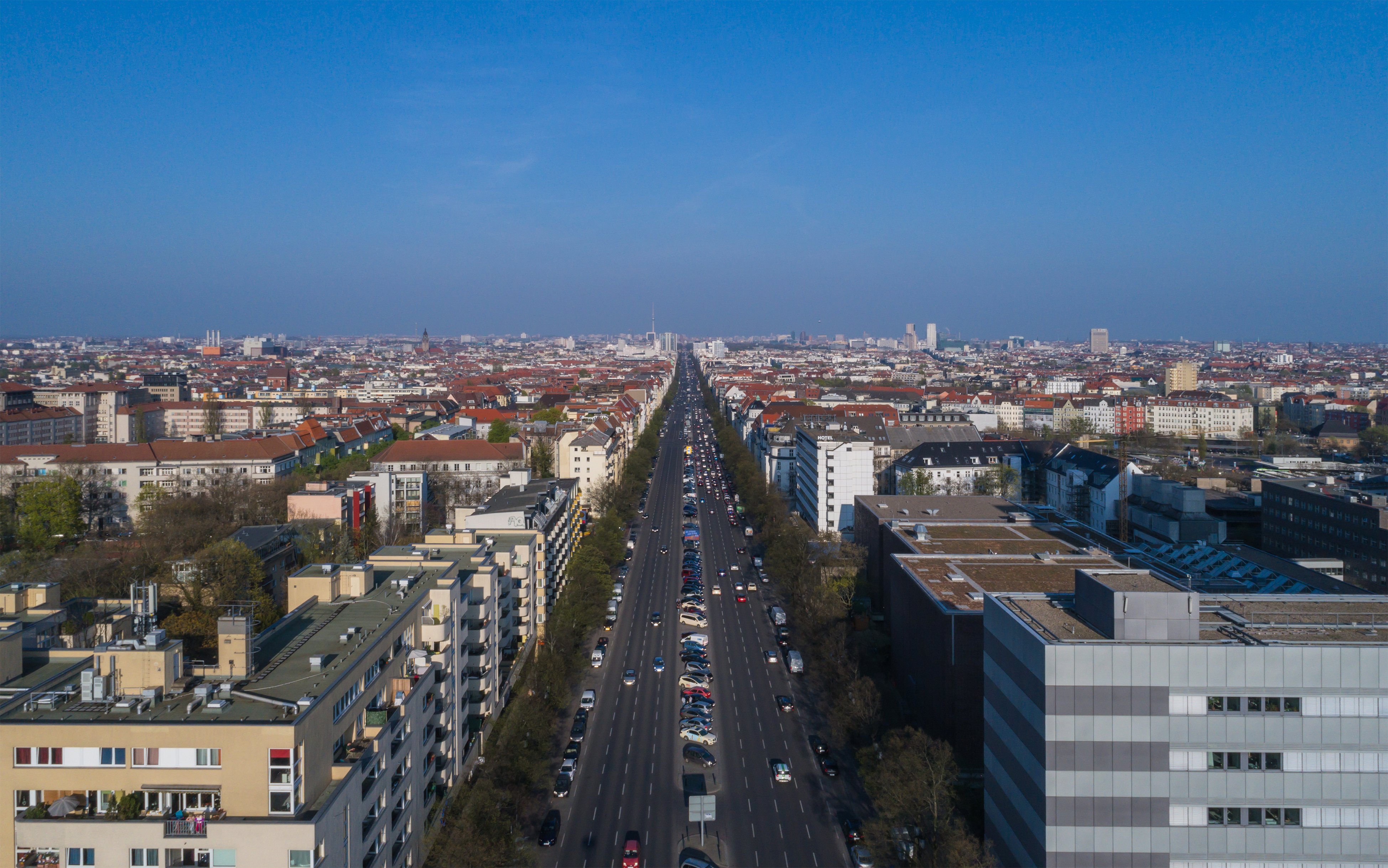
The Bundesstraße 2 (abbr. B2) is a German federal highway, running some 1000 kilometres from the Polish border near Gartz to the Austrian border near Garmisch-Partenkirchen. From north to south; it passes through major cities such as Berlin, Potsdam, Leipzig, Gera, Bayreuth, Nuremberg, Augsburg, and Munich. It is largely paralleled by Bundesautobahn 9, and a small portion coincides with Bundesautobahn 952. It corresponds to a long portion of the Via Imperii of the Holy Roman Empire which continued all the way to Venice via the Brenner Pass. In Berlin B2 forms among others the following squares and streets Alexanderplatz, Karl-Liebknecht-Straße, Unter den Linden, Straße des 17. Juni, Großer Stern, Kaiserdamm, Theodor-Heuss-Platz, and Heerstraße. {{DEFAULTSORT:Bundesstrasse 2 Roads in Brandenburg Roads in Berlin Roads in Saxony Roads in Saxony-Anhalt Roads in Thuringia Roads in Bavaria 002 002, 0O2, O02, OO2, or 002 may refer to: Fiction *002, fictional Bri ... [...More Info...] [...Related Items...] OR: [Wikipedia] [Google] [Baidu] |
Brandenburg
Brandenburg (; nds, Brannenborg; dsb, Bramborska ) is a states of Germany, state in the northeast of Germany bordering the states of Mecklenburg-Vorpommern, Lower Saxony, Saxony-Anhalt, and Saxony, as well as the country of Poland. With an area of 29,480 square kilometres (11,382 square miles) and a population of 2.5 million residents, it is the List of German states by area, fifth-largest German state by area and the List of German states by population, tenth-most populous. Potsdam is the state capital and largest city, and other major towns are Cottbus, Brandenburg an der Havel and Frankfurt (Oder). Brandenburg surrounds the national capital and city-state of Berlin, and together they form the Berlin/Brandenburg Metropolitan Region, the third-largest Metropolitan regions in Germany, metropolitan area in Germany with a total population of about 6.2 million. There was Fusion of Berlin and Brandenburg#1996 fusion attempt, an unsuccessful attempt to unify both states in 1996 and ... [...More Info...] [...Related Items...] OR: [Wikipedia] [Google] [Baidu] |
Munich
Munich ( ; german: München ; bar, Minga ) is the capital and most populous city of the States of Germany, German state of Bavaria. With a population of 1,558,395 inhabitants as of 31 July 2020, it is the List of cities in Germany by population, third-largest city in Germany, after Berlin and Hamburg, and thus the largest which does not constitute its own state, as well as the List of cities in the European Union by population within city limits, 11th-largest city in the European Union. The Munich Metropolitan Region, city's metropolitan region is home to 6 million people. Straddling the banks of the River Isar (a tributary of the Danube) north of the Northern Limestone Alps, Bavarian Alps, Munich is the seat of the Bavarian Regierungsbezirk, administrative region of Upper Bavaria, while being the population density, most densely populated municipality in Germany (4,500 people per km2). Munich is the second-largest city in the Bavarian dialects, Bavarian dialect area, ... [...More Info...] [...Related Items...] OR: [Wikipedia] [Google] [Baidu] |
Theodor-Heuss-Platz
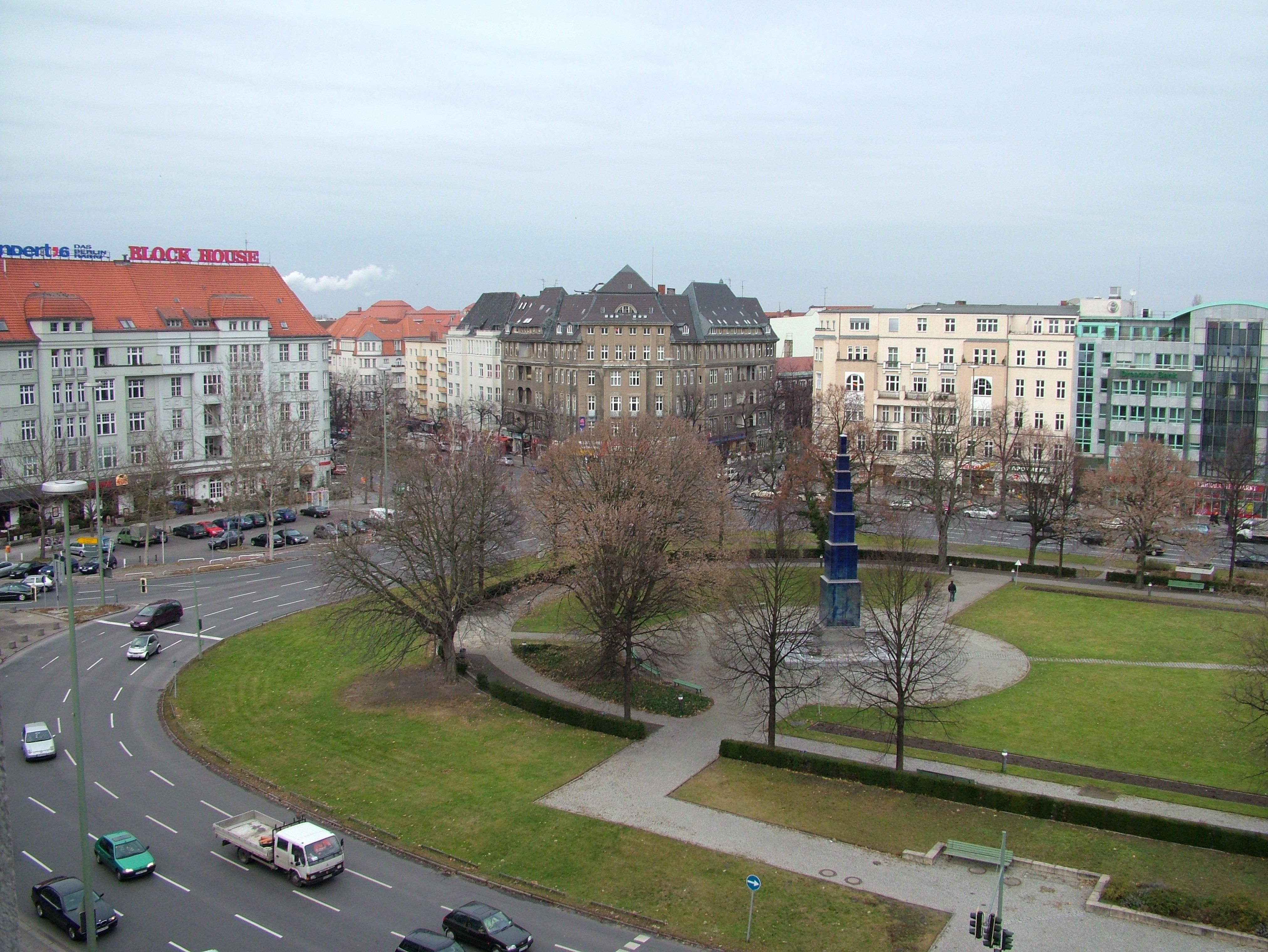
Theodor-Heuss-Platz (; colloquially called Theo by locals, ) is a large city square in the Westend district of Berlin, Germany. It is named after Theodor Heuss (1884–1963), the first President of Germany after World War II. Location The square is located at the western end of the wide Kaiserdamm boulevard, leading via Bismarckstraße, Straße des 17. Juni with the Berlin Victory Column and Brandenburg Gate in a direct line to Pariser Platz, Unter den Linden and the site of the City Palace in Berlin-Mitte. The axis is continued to the west by the Heerstraße up to Scholzplatz and further towards Spandau and the Berlin city limits. Underneath the square is the U-Bahn station Theodor-Heuss-Platz. History The square was laid out as part of the development of the new Westend district between 1904 and 1908 and then named ''Reichskanzlerplatz'' after the office of the Imperial Chancellor. When the eponymous U-Bahn station was inaugurated by Emperor Wilhelm II on 29 March 1908, t ... [...More Info...] [...Related Items...] OR: [Wikipedia] [Google] [Baidu] |
Kaiserdamm
Kaiserdamm is a boulevard in the Westend and Charlottenburg districts of Berlin, Germany. Route Kaiserdamm is a 50m wide road, that runs for between Sophie-Charlotte-Platz in the east to Theodor-Heuss-Platz in the west. It forms a westward continuation of Bismarckstraße, Straße des 17. Juni and the Unter den Linden boulevard. History Originally an unpaved track, the road was inaugurated at the behest of Wilhelm II (after whom it is named), and opened to traffic in 1906. The road was rebuilt in 1939 as part of the East-West Axis of the planned Welthauptstadt Germania, and much of the road as it is today dates from this time. Buildings Kaiserdamm is served by the Kaiserdamm U-Bahn station positioned halfway between the Theodor-Heuss-Platz U-Bahn station and Sophie-Charlotte-Platz U-Bahn stations. Prominent buildings on the road include the studios of Rundfunk Berlin-Brandenburg Rundfunk Berlin-Brandenburg (; "Berlin-Brandenburg Broadcasting"; abbreviated: RBB , s ... [...More Info...] [...Related Items...] OR: [Wikipedia] [Google] [Baidu] |
Großer Stern
Der Große Stern (''The Great Star'') is the central square of the Großer Tiergarten park in Berlin; the Berlin Victory Column The Victory Column (german: , from ''Sieg'' ‘victory’ + '' Säule'' ‘column’) is a monument in Berlin, Germany. Designed by Heinrich Strack after 1864 to commemorate the Prussian victory in the Second Schleswig War, by the time it was ... is sited in it. Squares in Berlin Tiergarten (park) {{Berlin-geo-stub ... [...More Info...] [...Related Items...] OR: [Wikipedia] [Google] [Baidu] |
Unter Den Linden
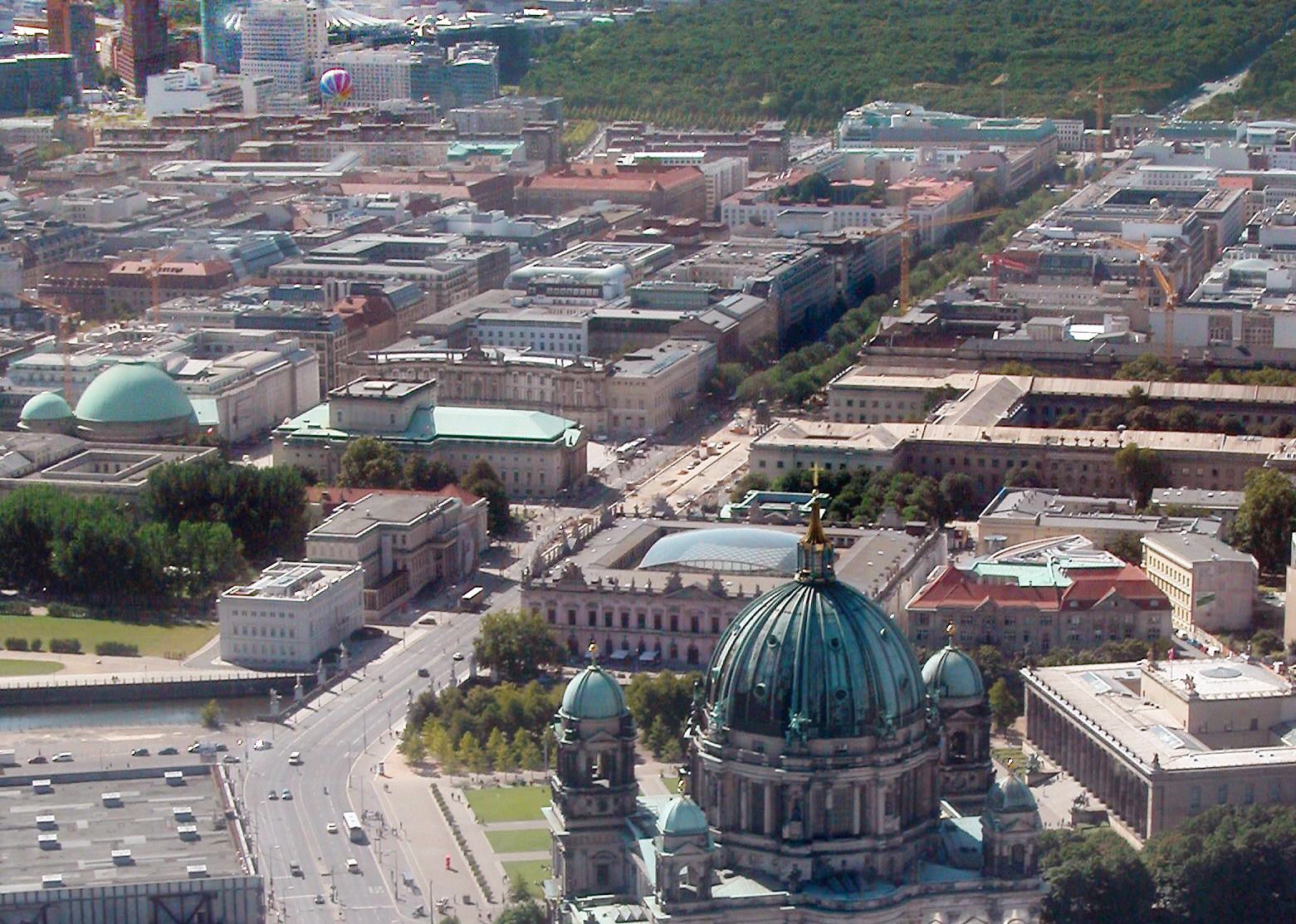
Unter den Linden (, "under the linden trees") is a boulevard in the central Mitte district of Berlin, the capital of Germany. Running from the City Palace to Brandenburg Gate, it is named after the linden (lime in England and Ireland, not related to citrus lime) trees that line the grassed pedestrian mall on the median and the two broad carriageways. The avenue links numerous Berlin sights, landmarks and rivers for sightseeing. Overview Unter den Linden runs east–west from the site of the Stadtschloss royal palace (main residence of the House of Hohenzollern) at the Lustgarten park, where the demolished Palace of the Republic once stood, to Pariser Platz and Brandenburg Gate. Eastward the boulevard crosses the Spree river at Berlin Cathedral and continues as Karl-Liebknecht-Straße. The western continuation behind Brandenburg Gate is Straße des 17. Juni. Major north–south streets crossing Unter den Linden are Friedrichstraße and Wilhelmstrasse. Unter den Linden, w ... [...More Info...] [...Related Items...] OR: [Wikipedia] [Google] [Baidu] |
Karl-Liebknecht-Straße
Karl-Liebknecht-Straße is a major street in the central Mitte district of the German capital Berlin. It is named after Karl Liebknecht (1871–1919), one of the founders of the Communist Party of Germany. The street connects the Unter den Linden boulevard with the Prenzlauer Allee arterial road leading to the northern city limits. Although part of the street dates back to medieval times, most of the buildings at its side were built in the 1960s, when East Berlin's centre was redesigned as the capital of East Germany. History The origins of the street lie in the quarter that arose about 1270 around St. Mary's Church, located north of Alt-Berlin's initial settlement. The "New Market" (''Neuer Markt'') square beneath the church was first mentioned in a 1292 deed; there were three alleys that went southwest from it down to the Spree river. They had had different names over the centuries and were ultimately known as Papenstraße (“Bishops' Street”, named for the Berlin residenc ... [...More Info...] [...Related Items...] OR: [Wikipedia] [Google] [Baidu] |
Alexanderplatz
() ( en, Alexander Square) is a large public square and transport hub in the central Mitte district of Berlin. The square is named after the Russian Tsar Alexander I, which also denotes the larger neighbourhood stretching from in the north-east to and the in the south-west. is reputedly the most visited area of Berlin, beating Friedrichstrasse and City West. It is a popular starting point for tourists, with many attractions including the (TV tower), the Nikolai Quarter and the ('Red City Hall') situated nearby. is still one of Berlin's major commercial areas, housing various shopping malls, department stores and other large retail locations. History Early history to the 18th century A hospital stood at the location of present-day since the 13th century. Named (St. George), the hospital gave its name to the nearby (George Gate) of the Berlin city wall. Outside the city walls, this area was largely undeveloped until around 1400, when the first settlers began ... [...More Info...] [...Related Items...] OR: [Wikipedia] [Google] [Baidu] |
Brenner Pass
The Brenner Pass (german: link=no, Brennerpass , shortly ; it, Passo del Brennero ) is a mountain pass through the Alps which forms the border between Italy and Austria. It is one of the principal passes of the Eastern Alpine range and has the lowest altitude among Alpine passes of the area. Dairy cattle graze in alpine pastures throughout the summer in valleys beneath the pass and on the mountains above it. At lower altitudes, farmers log pine trees, plant crops and harvest hay for winter fodder. Many of the high pastures are at an altitude of over ; a small number stand high in the mountains at around . The central section of the Brenner Pass covers a four-lane motorway and railway tracks connecting Bozen/Bolzano in the south and Innsbruck to the north. The village of Brenner consists of an outlet shopping centre (supermarkets and stores), fruit stores, restaurants, cafés, hotels and a gas station. It has a population of 400 to 600 (). Etymology Older, obsolete theo ... [...More Info...] [...Related Items...] OR: [Wikipedia] [Google] [Baidu] |
Venice
Venice ( ; it, Venezia ; vec, Venesia or ) is a city in northeastern Italy and the capital of the Veneto Regions of Italy, region. It is built on a group of 118 small islands that are separated by canals and linked by over 400 bridges. The islands are in the shallow Venetian Lagoon, an enclosed bay lying between the mouths of the Po River, Po and the Piave River, Piave rivers (more exactly between the Brenta (river), Brenta and the Sile (river), Sile). In 2020, around 258,685 people resided in greater Venice or the ''Comune di Venezia'', of whom around 55,000 live in the historical island city of Venice (''centro storico'') and the rest on the mainland (''terraferma''). Together with the cities of Padua, Italy, Padua and Treviso, Italy, Treviso, Venice is included in the Padua-Treviso-Venice Metropolitan Area (PATREVE), which is considered a statistical metropolitan area, with a total population of 2.6 million. The name is derived from the ancient Adri ... [...More Info...] [...Related Items...] OR: [Wikipedia] [Google] [Baidu] |
Holy Roman Empire
The Holy Roman Empire was a Polity, political entity in Western Europe, Western, Central Europe, Central, and Southern Europe that developed during the Early Middle Ages and continued until its Dissolution of the Holy Roman Empire, dissolution in 1806 during the Napoleonic Wars. From the accession of Otto I in 962 until the twelfth century, the Empire was the most powerful monarchy in Europe. Andrew Holt characterizes it as "perhaps the most powerful European state of the Middle Ages". The functioning of government depended on the harmonic cooperation (dubbed ''consensual rulership'' by Bernd Schneidmüller) between monarch and vassals but this harmony was disturbed during the Salian Dynasty, Salian period. The empire reached the apex of territorial expansion and power under the House of Hohenstaufen in the mid-thirteenth century, but overextending led to partial collapse. On 25 December 800, Pope Leo III crowned the List of Frankish kings, Frankish king Charlemagne as Carolingi ... [...More Info...] [...Related Items...] OR: [Wikipedia] [Google] [Baidu] |


.jpg)